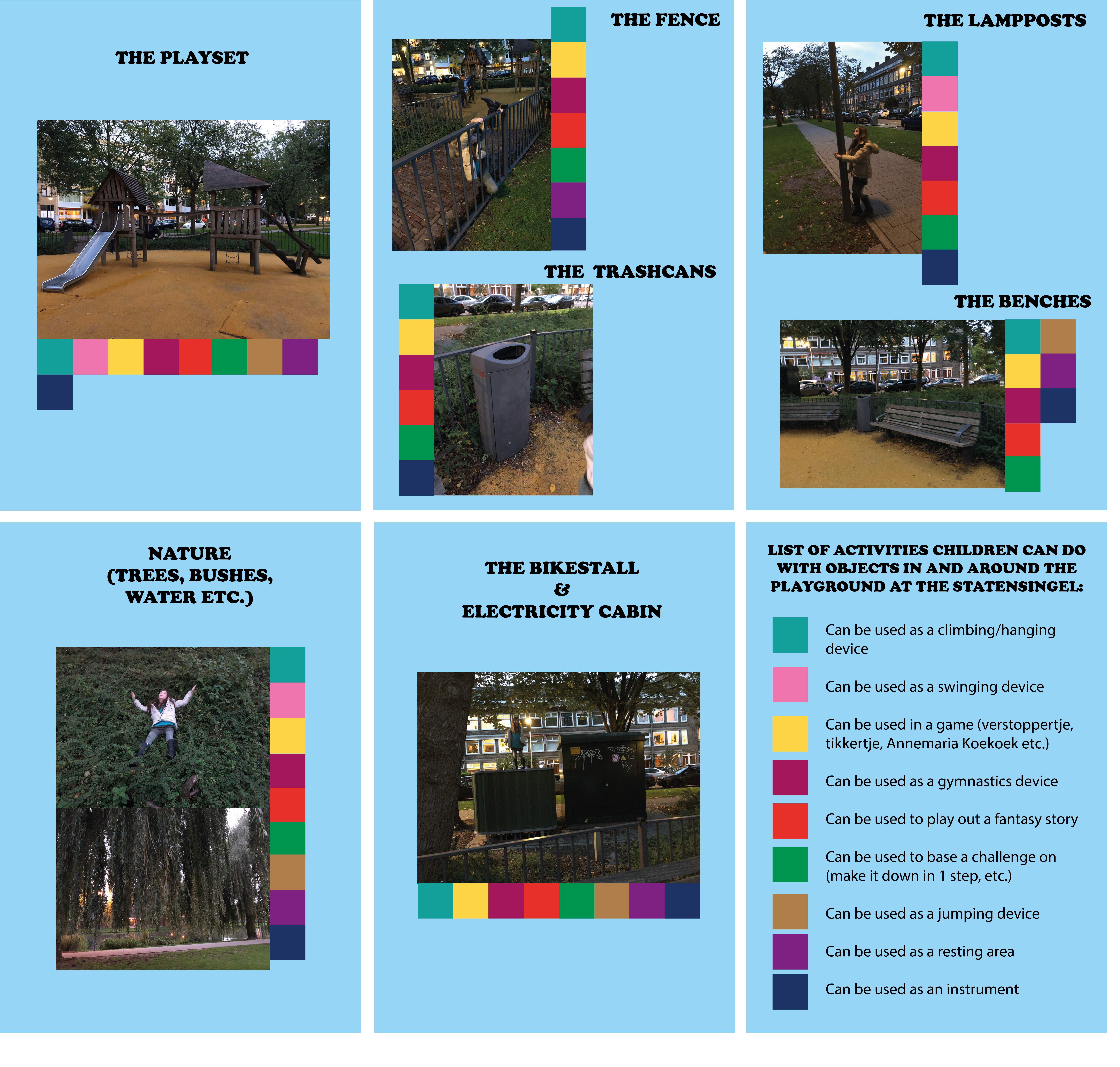
MAPPINGS
This first mappings shows multiple objects in and around the playground and how they can be used when playing. This mapping combines body movements with the spatial setting, as it shows the objects involved in the space and how bodies move trough/because of/around them. I made a list of activities children can do but it really could be endless, these are just a few first examples.
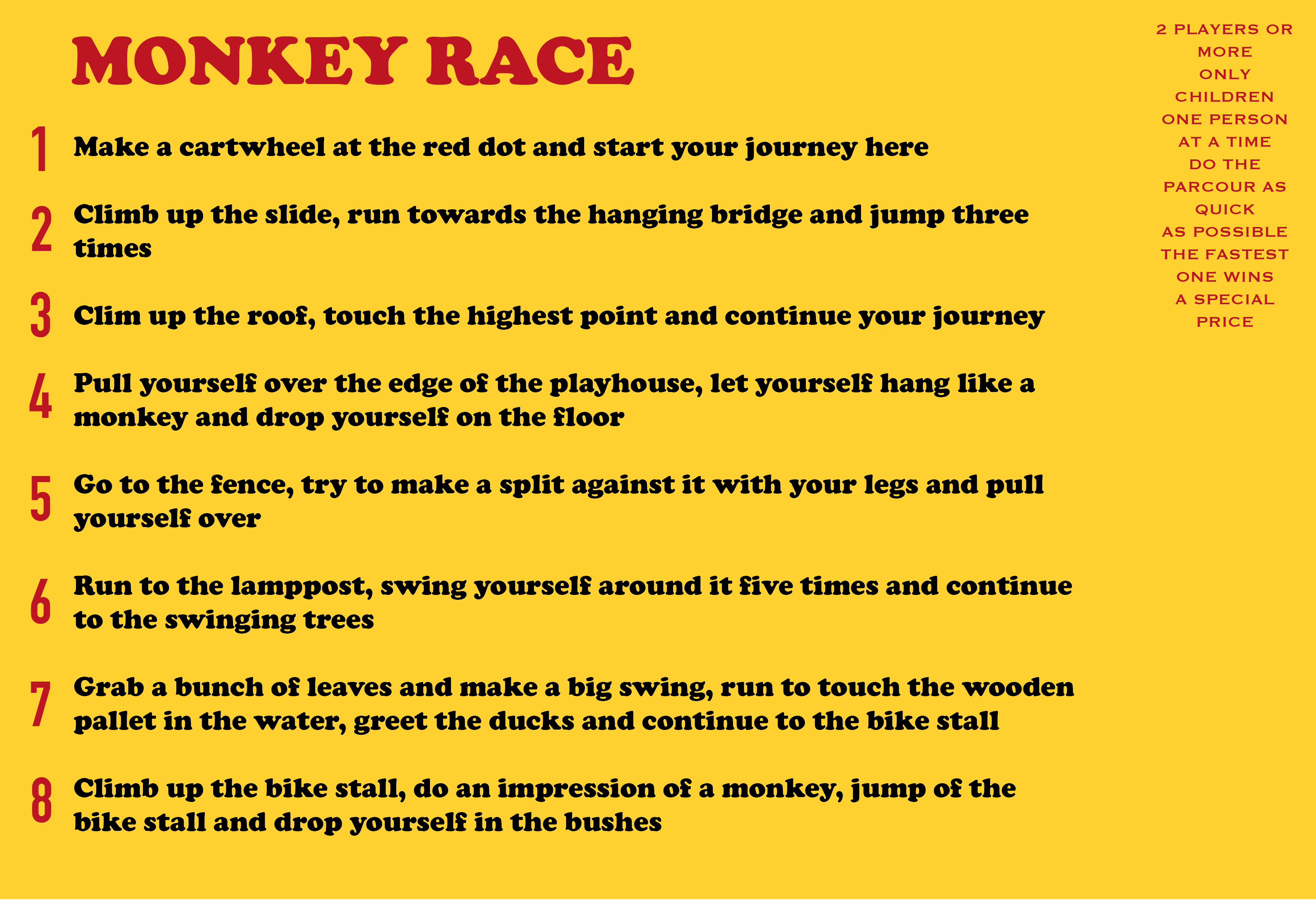
THE BODY MOVEMENTS IN THE SPACE
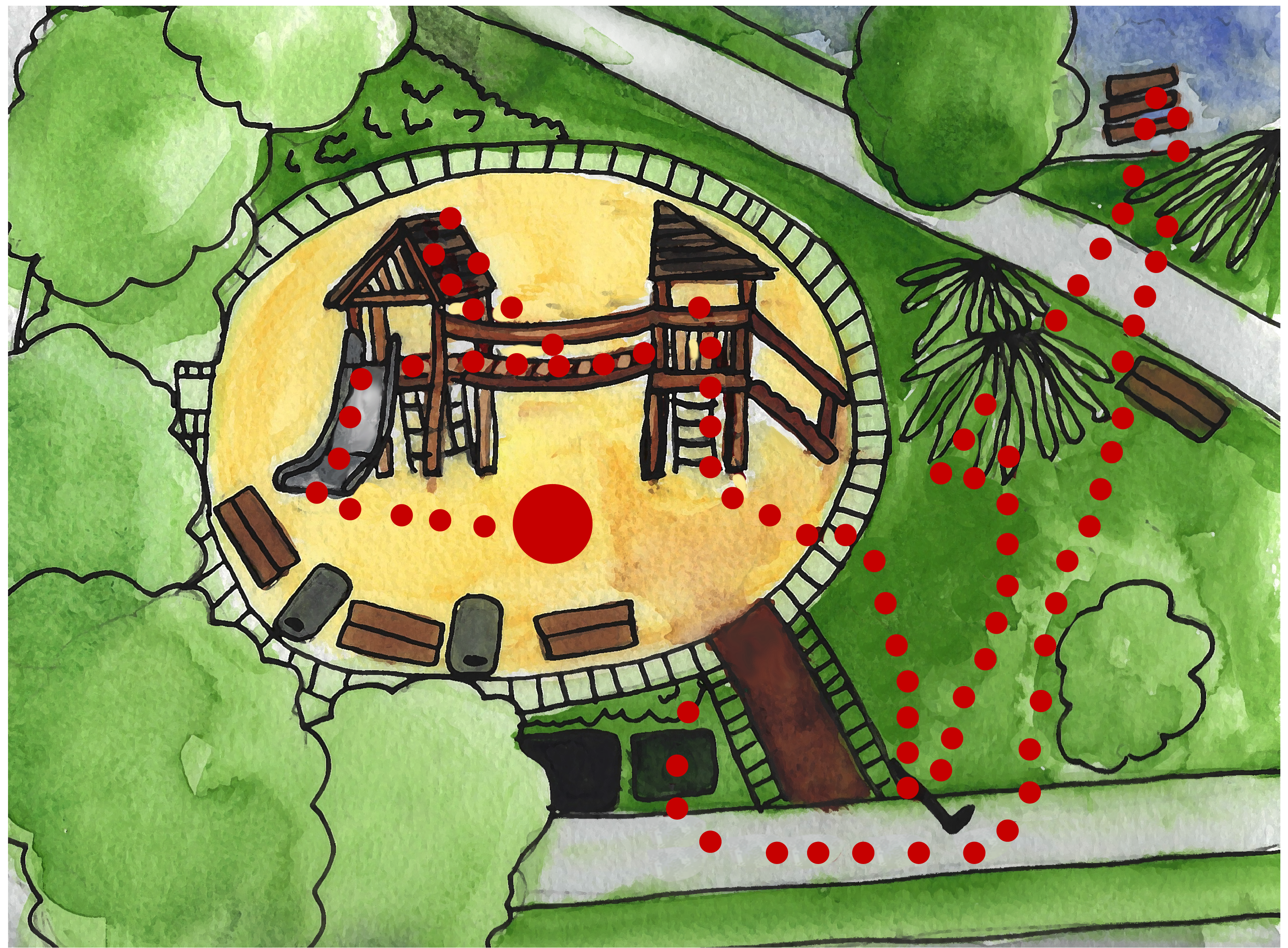
This is my mapping to answer the questions surrounding the topic of how bodies can move around a space. As I wanted to use the experience and point of view from children I came up with a parcour that could be done by kids to win a special price. It involves some of the actions I observed when visiting the playground with the kids I baby sit, it uses the playset as a starting point so that's why it's in the center of the drawing. I made a watercolor drawing to make this game more appealing to children as they're the focus of my research.
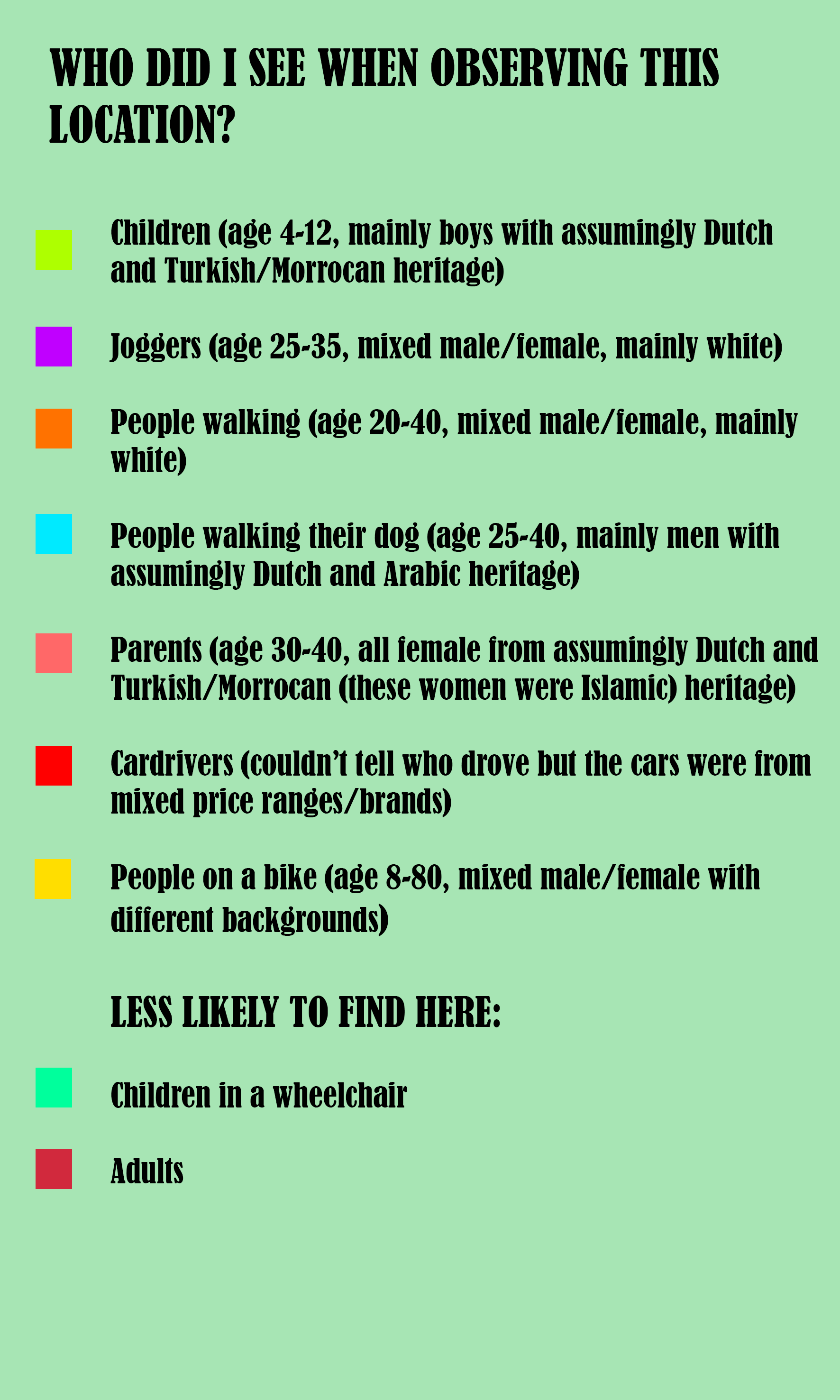
THE SPATIAL SETTING
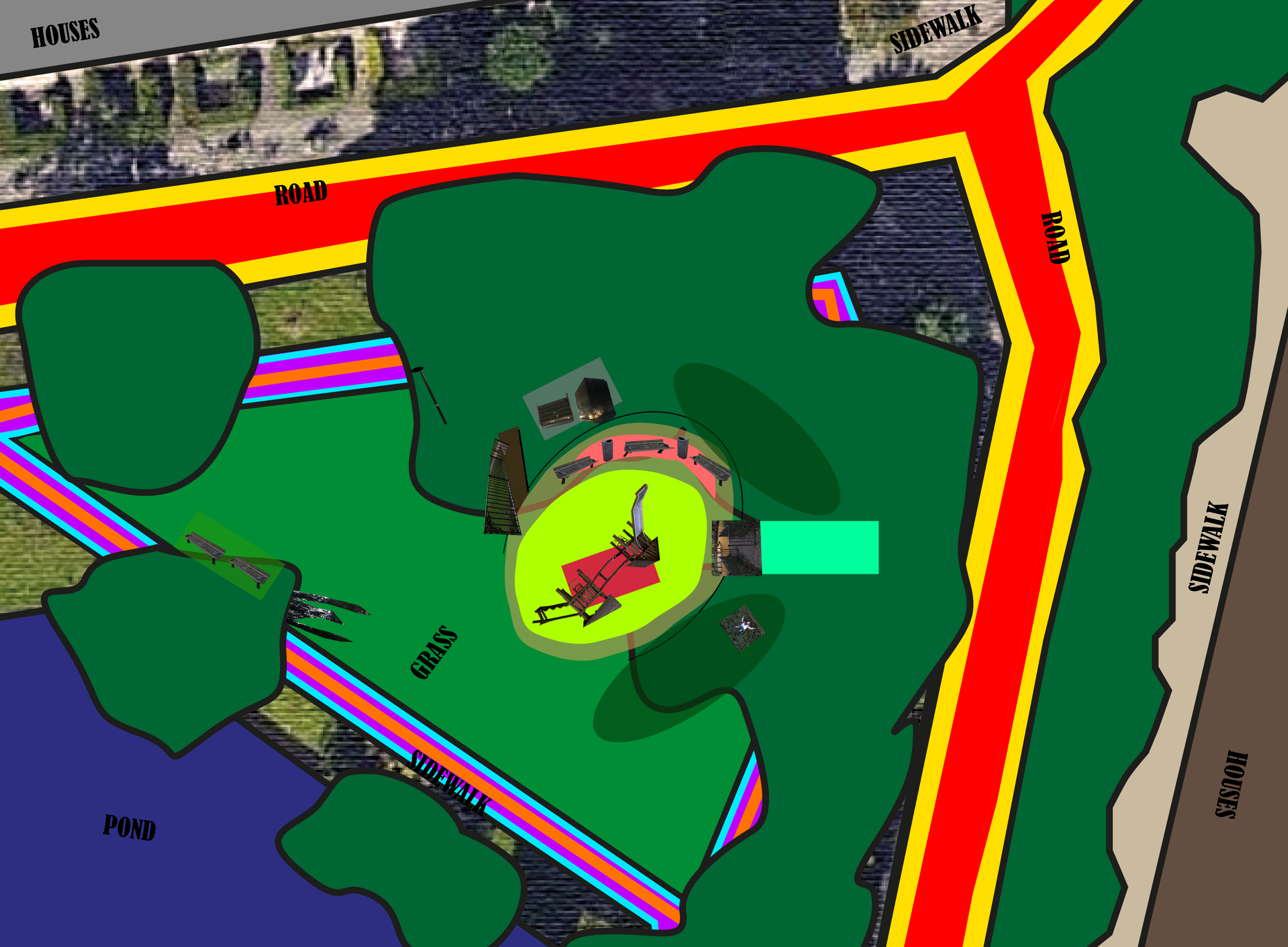
This mapping shows the objects and location who together make the playground. You can see their scales and position on a overdrawn screenshot from a satellite picture from Google maps. This mapping also answers a question about what bodies are involved in the space. I mapped out the people I observed when visiting the playground, I also wrote down the people the space excludes. The entrance is not wheelchair friendly and the play set is designed for children, so adults can't fit inside it. Well, they probably can when they really try but it's not ideal.
THE WIDER CONTEXT OF THE SPACE
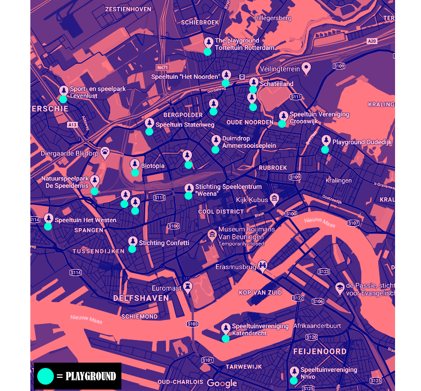
Finally, these are the mappings that surround the topic of the space in a wider context. I wanted to find out who initiated the playset and who designed it and why, so I called the municipality of Rotterdam. After a long wait they were browsing their information but couldn't find a registration of the playground. This meant that the municipality wasn't responsible for this playset so that leaves a big question mark about the origin of the area. They put out an information request so I might hear some more information between now and four weeks. I found a picture on Google maps of the playground in 2008, and I found out it looked different from 2008 to somewhere between 2014/17, it didn't say an exact date. The area just consisted of one plastic slide so it got an upgrade. I got another call later from the municipality, the woman on the phone told me that there is a possibilty that this upgrade was initiated by a local private. There is a chance the previous slide was so popular so they upgraded it. The lady wasn't sure though so she assured me I would get more information soon. Because of this big question mark I decided to it into a children's story. Dave and Elise, my baby sit kids, helped me in my research so I decided to call the story "Dave & Elise And The Big Playground Mystery". I wanted to stay in the experience of children so making this mapping a poster for a children's book/movie was only fitting. I also made a map with all the registered playgrounds in Rotterdam.
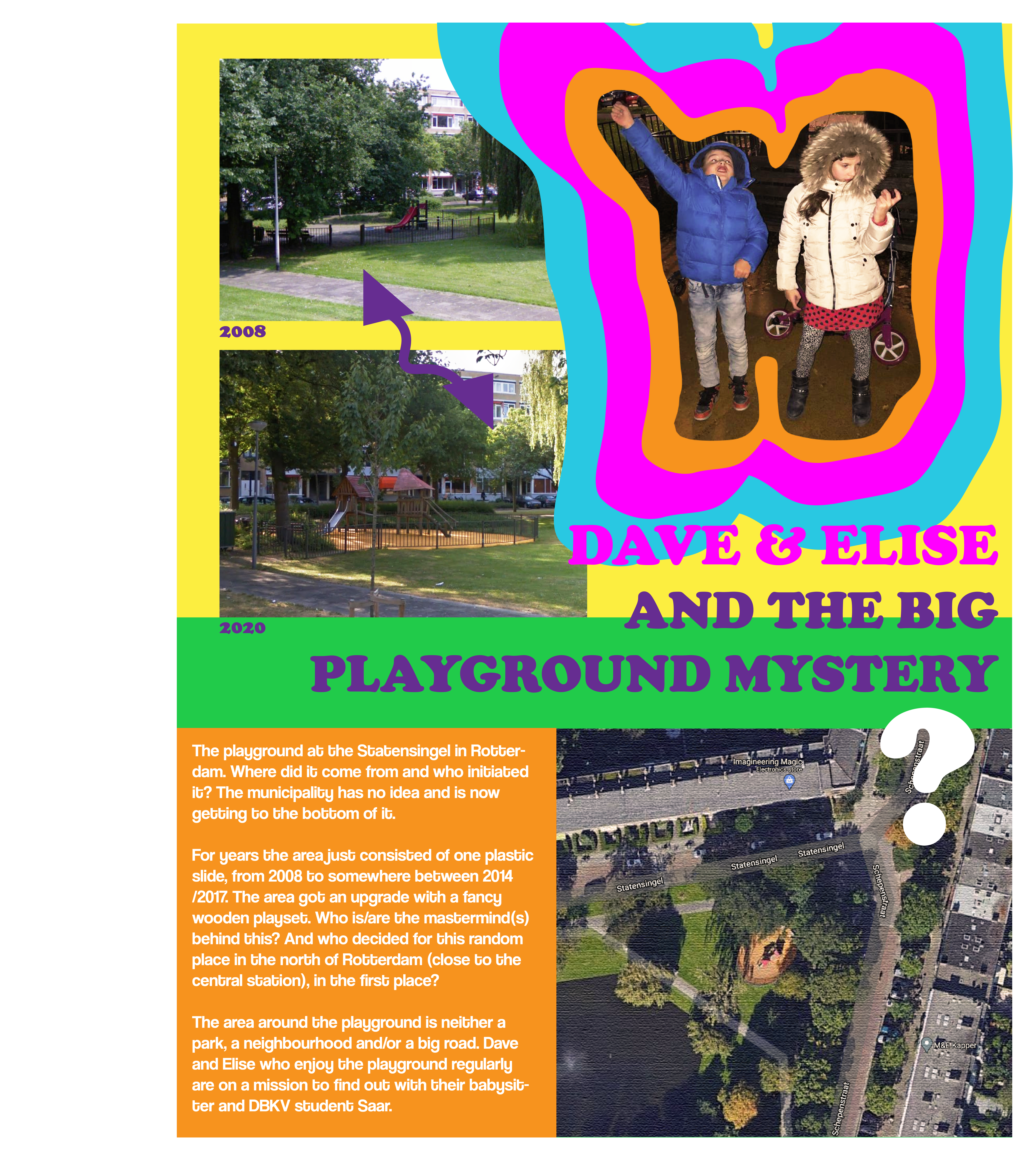
Sidenote - I could tell that the woman were Islamic because they wore a hijab.